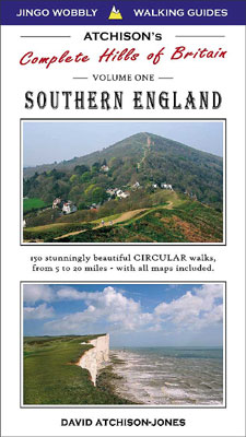
 |
|||||||
ATCHISON WALKING & FELL RUNNING - HOW TO USE THE GUIDEBOOKS
The most innovative concept about our walking books, is that you don't have to decide on 'WHERE,' or 'HOW LONG' you are going walking - until the very last minute. As very experienced walkers ourselves, we realise that the weather often dictates the amount of time you will actually want to spend walking in a day.
We achieve this by offering 3 different lengths of walk - from sometimes the same location, or at other times a different start point - that is usually no more than 5 mins drive away.
The second reason that we can offer alternative walks, is because our maps are of such high quality and cover such a large area. We illustrate everything on our maps that is of particular use to walkers and runners, and simplify everything else to make interpretation very easy indeed. This allows the reader to see our suggested route at an instants glance, but also plan their own detours, or make up their own routes from our map.
BOOK DESIGN
You will need a normal car atlas to get to the parking location for our walks, we do not try to give up to date road mapping since this is only possible from a government body such as the Ordnance Survey. Alternatively, we do give the grid reference for all of the start points that you can feed into a navigation system. We do however, re-colour roads on our maps so that yellow is generally quiet and not to bad to walk along, brown if moderately busy and OK to walk along, and red is very busy - and best to keep clear. We feel that walkers prefer to know if an official B road - is actually a main thoroughfare with tons of traffic and awful to walk along. (Please contact us if you feel any roads are coloured incorrectly). We mark footpaths, b/w and tracks. Again, we try to help the 'real walker.' In our experience, some footpaths are actually used as bridleways and get very churned up - so we try to reflect reality, rather than acutal rights of way. (See up to date Ordnance Survey Maps for rights of way). We often mark on out of use footpaths (as empty squares on a dashed line). These have lost their right of way status, but it is hoped that one day better access will be granted to more areas in Britain. It is also very interesting to see where this has happened, and where it has not - needless to say that one might point the finger in certain directions!
COLOUR CODED TIMING POINTS
- All along our suggested walks there are colour coded times.
- These directly link in with the text with the same colour coded bullet points.
- This enables the reader to quickly flick back and forth from the map to find descriptions.
- The times are purely for navigation - so every part of the walk is exactly labelled.
- By subtracting times from each other, you can easily calculate how far ahead the next turning is.
- We suggest adding 20 mins per hour overall for photos, looking at the view etc.
- All timings have been done by David Atchison-Jones who slows down considerably when going up hill.
- The timings do however give a very accurate minimum time you will do the walk - or get back to the start.
- If you do decide to do the walk as a fell run, then the times will be highly accurate - but slow.
- See the Fell Running tab for final timing percentages
BENDING THE BACK OF THE BOOK - NYLON STRETCH THREAD
The design of the binding is special. We have chosen special paper that is sewn together, and use a card cover which is glued on. The sewing will keep the book together through a real bashing. The card cover however gives the binding terrific flexibility. You should be able to open the book and bend it completely back on itself with the covers touching. By squeezing on the spine with it fully opened back, it allows the book to flex without breaking. This will in turn allow the book to lay open - completely flat, and make using the double page maps very easy. The thread used in binding is nylon and will stretch - unlike the old cotton thread that would simply break - don't try this on old books!
|
|
|||||||

|
SPONSORS
|