 |
|||||||
ATCHISON WALKING & FELL RUNNING - MAPPING
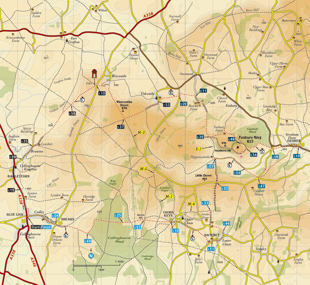
We construct all the maps ourselves from imperial land surveys, that consequently makes them superbly accurate alongside other leading maps on sale. The contour lines are set at feet, the traditional measurement used to classify British Hills into Munros, Corbetts, Welsh 3000's etc.
All of our maps have the standard grid for the UK, and from 2009 have full grid markings with area letters that will link in with any GPS system. Map squares are kilometre squares, and at normal walking pace of 3 miles per hour, it takes 12 mins to walk across a square (regardless of actual scale on the map).
From this technical mapping, we then add our own completely new modern graphic design to produce a special map that is entirely designed for 'Walkers.'
We expand the landform for every map so that all of the walks fit perfectly on every double page layout. The scale is therefore to the maximum detail possible on every map we produce for each individual walk. Only after this has been completed, is any information placed on the map. This makes our maps the clearest maps available to walkers and are perfectly designed.
All of the contours are tinted by hand, to illustrate the valleys and hill tops at an instants glance. Since the areas included in the whole series are so diverse, it would be impossible to have a colour scheme that worked for small hills in the South of England - as well as Ben Nevis, therefore every map is coloured individually by hand.
We have used special transparency effects for the forests so that you can still see the landform through them. In parts the shading is controlled if the woodland needs more emphasis. The urban areas are semi-transparent in order to enhance the route of footpaths when they pass through built up areas.The roads are colour coded on the basis of how un-appealing they are to walk on, should you need to take a shortcut or plan your own route. Needless to say, that a red road is the least desirable thoroughfare.
The Big Walk is marked on each map with a red and white dashed line, and timing points are given along the entire length of the route. Yellow markers illustrate where the short and day walks deviate from the Big Walk. All of this colour coded detail appears in the text with the same colour code (Black going to Turquoise). On some maps, alternative running routes are illustrated where it offers better running terrain.
|
|
|||||||
|
SPONSORS
|